
Addressed to my daughter Johanna and her then-boyfriend (now-husband) Thomas in anticipation of doing this ride together, which we did, a few months later, along with her now-father-in-law Jean-Pierre!
 Twenty six miles out and back (42 km), starting elevation 3,000 ft (909 m), maximum elevation 4,205 ft (1,274 m), and 2,700 ft (818 m) of ascent and descent. Four liters each (hah, metric!) of fluids consumed en route in six hours. But that’s putting the cart before the horse. We knew none of that until I had a GPS track to inspect, afterwards.
You remember that Penny and I “burst through” the Tortolitas on foot with our friends Bill and Amy in order to explore the North East corner of the Tortolita mountain preserve, during which we saw the start of a mountain bike loop trail ascending the mountain in switchbacks; a remote trail recommended and maintained by Neil Stitzer and the Marana Parks and Recreation trail crew.
Also, that on another day I reconnoitered by motorcycle to find the mountain bike trail leading to the North East entrance from civilization (if that is what an Arizona housing development represents). And, that I planned to ride the whole enchilada by mountain bike in preparation for your visit in October and in the hope that this may just be the awesomest ride and day out for yourselves and Jean-Pierre, after Havasu Falls.
I realized that for the test ride to be completely legitimate, I had to ride it with a Frenchman. I invited Eric Wegrzyniak, a real Frenchman despite his name (sorry, Eric!) who we know from Strasbourg days, and who has a very entertaining story of “riding” the Samaniego trail down Mt. Lemmon on a mountain bike only on the third attempt, after being benighted both on the group’s first attempt, and then again on their subsequent attempt two weeks later to rescue the abandoned bikes! (This YouTube video of the route shows bikes being roped down a cliff face at about 6’ 40”.) So clearly, Eric was the perfect choice.
Last Saturday, April 11 we left our house at 7:30 am, drove just six miles up Rancho Vistoso with our bikes in the truck bed, and started riding at 8.00 am. The first eight miles or so are a beautiful ride winding through the desert, slightly uphill overall but nevertheless fast in parts, on a sandy but firm trail. We saw half a dozen hares with ears at least a foot long, who may have been mad in March but in April were simply shy.
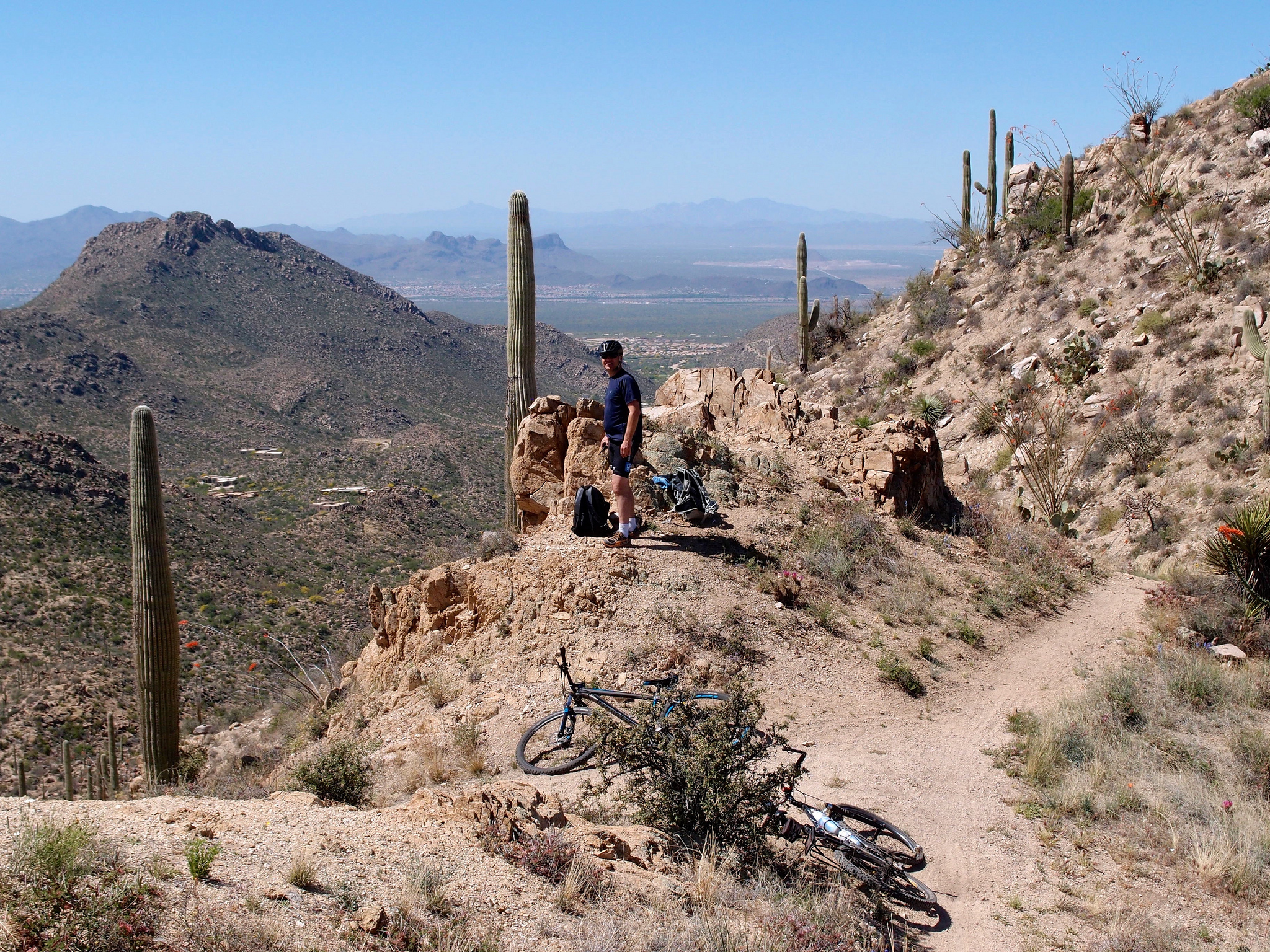
I did get off and push my bike on some of the uphill’s, and that became my pattern for the day. Eric mostly led, because he is younger and stronger and fitter than me, and besides, there could be snakes. There is a steep climb and a rocky section up to the pass which I think of as the “North East entrance”, and then a steep jeep trail down to Wild Burro tank, where there is, yes, a water tank, a ruined building, a disused windmill and a ruined dam in the wash of a dry stream bed.
This is a good place for a rest, and one of probably only two places on the entire route with shade from the sun. The Loop trail starts from here, ascends to the Ridgeline trail, which in turn rides the crest before descending to join Wild Burro trail at Alamo Springs, about five miles from Wild Burro tank and the lowest point of the loop portion of the route within the Tortolita mountains.
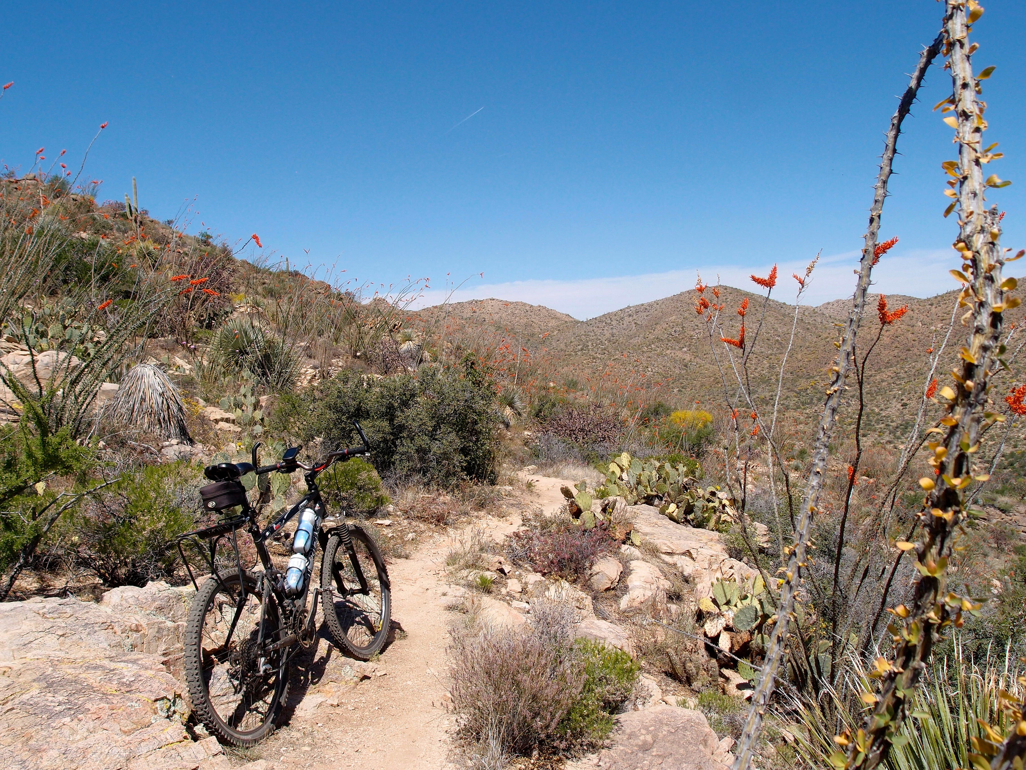
I huffed and puffed my bike up the switchbacks and spotted two large javelina waltzing in a distant wash below. The flowers were magnificent following a wet Winter, with groves of orange tipped ocotillo and cacti blooming red, yellow and magenta. Every plant seemed to sport a primary color amid its spines and spikes.
The ridgeline trail is the jewel in the crown (this crown of thorns?). The trail surface is still firm and very good quality, it is maintained after all, but it is narrow and twisty in places, with some exposure to fairly steep drops on the side of the mountain. You need to be confident, to have good balance and good control of the bike, especially on the downhill. This part of the trail breaks into fabulous views to the South, of the nearby Tucson mountains, further off to the sacred Baboquivari peak, and to Mt. Wrightson in the Santa Ritas over and beyond the city of Tucson.
Alamo Springs is the second place with decent shade, and a meeting point of several trails which Penny and I have now hiked several times, in different combinations, and only about three miles up Wild Burro wash from a Ritz Carlton resort hotel. You wouldn’t believe it if you were helicoptered in blindfold and set down in the wash. This is also approximately the half-way point, and a good spot for lunch.
The Wild Burro trail is looser to begin with, and uphill of course, and this was the most tiring part for me after the exhilaration of the mountain tops, the views, and a descent. I wouldn’t say this route overall is technical, the trail is very good quality most of the time, but I would say it is demanding. There aren’t many places to relax! I would also say it is one of the finest, if not the finest, mountain bike ride in greater Tucson.